What I worked on this summer... 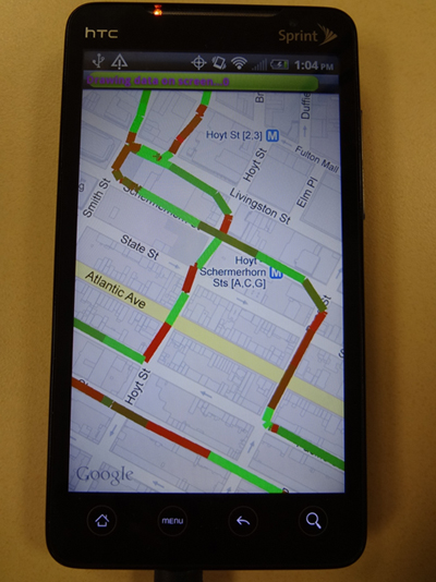
I created a Parknet application for the android environment. It will essentially work on any android powered device and will do what the desktop application can do. It takes data from the WINLAB server which can include cars driven around winlab or data from a drive in Brooklyn and turns it into a user freindly map with line overlays that indiate range finder distances at certan geo locations.
How it works...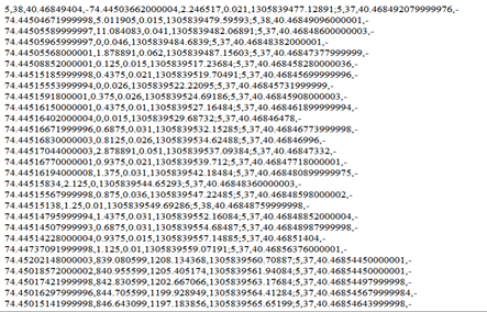
The android application makes use of the Google maps api so the foundation of the program is essentially Google maps. I have just added overlays on top of the map to show the required information. First I gather the data from the server for a certain date such as November 3rd 2010 in which there were 5 cars which drove around Brookyln and collected parking data. A sample of how this data looks like is shown to the right.
Then I take this data and calculate the appropriate color to use based on the distance given from the range finder. This distance from 0-255 determines what shade of red or green that will be drawn as the line color. I take the Geolocations of the car and draw a line between two adjacents GeoPoints which are longitude/latitude locations. The lines are drawn for the entire data set which can be customized by day, time of day, and number of cars. Currently only previously collected data is being used. So, for example if I were to choose November 3rd, 2010, all the data from the five cars can be drawn for the entire day on the screen and you will be able to see the roads in which the cars drove and the colors of the lines will indicate the distances from the rangefinder. Red being an object close to the car and green being an object far away.
Features
Color Coding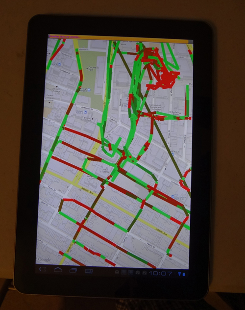
Each and every line is colored based on the readings and is located from where the car recorded that certain reading.
Progress Bar
The progress bar was implemented to track the time it took to connect to and wait for the server and how long it took to draw all the lines overlays onto the map.
Multithreading
Multithreading was the biggest effeciency improvement in that it made the program feel very snappy and there was no wait to access the map screen.
Data Filter
Filter the data to only show whats on the screen when the user pans or zooms in and out. This made the entire zoom/pan process faster since there were less points to be handled with on the screen at a time.
Calender
The calender feature is there to pick different dates so you can see data from different days in the past. This was implemented to make the application more versatile.
Compatability
The application can easily be ported to different android devices as long as the google maps api is support. And the application will keep all of its features intact. Moving the application to the tablet was very easy.
Whats next?
The Parknet application still has a long way to go. Having the system predict whether a car would be parked at a certain location at a certain time, finding out where parking locations are located in a city, and incorporating real time data are future goals of the project.