A little background...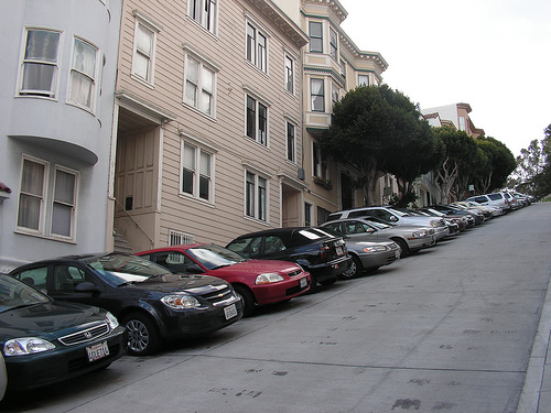
Parking can be very troublesome in heavily populated areas. Donald Shoup, a UCLA professor, reports that between 8% to 74% of city traffic is caused by people that are looking for a parking spot and also people spend about 3 to 14 minutes of driving just to find one. The professors at WINLAB decided that there should be a way to reduce this time so that there will be less congestion and provide people with information about available parking spots before or while they are searching for a spot so that they can find one faster.
Objective
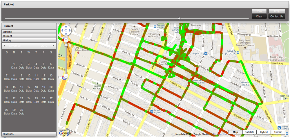
Parknet's objective is to provide its users with parking availability through a color coded map in which users can see where parking is available and where parking is not.
How it works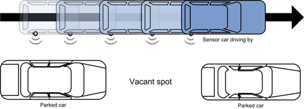
A car with an attached sensor drives by parking spaces and uses a Rangefinder to detect and report distances as well as the geolocation of the parking spot. This data is then sent to various application who interpret the data and present it to users in a graphical user-freindly manner. The online application features a map with red and green overlays which indicate whether a car is parked in that location or not.
Online Application
Whats Needed?
The Parknet project still has a long way to go and one major area is in user accesability. There is an online application for Parknet, however, there is no easy way a user can acces parking information while he is driving. Thus, development for smartphones or android powerd devices is essential for the Project. This is the area I worked on this summer.